A mortgage lender needs accurate information before approving a home loan. If property records are outdated or the home has changed since the last survey, the lender may request an updated mortgage survey. Having current survey information helps confirm the property’s boundaries and improvements, reducing the risk of delays before closing.
Why a Lender Wants Current Property Details
A mortgage lender puts a lot of money on the line, so it wants clear proof of what it’s funding. Before approving a loan or clearing a closing, the lender often asks for a current picture of the property, and a mortgage survey is one common way to get it. The goal is simple: confirm the home and its boundaries match the paperwork.
Lenders worry about anything that could hurt the property’s value or their claim to it. A building that crosses a line, a missing easement or a boundary question can all put their investment at risk. Current details help them lend with confidence instead of guessing.
This request is routine. Lenders make the same check on countless loans to protect the money they put in. Once the property checks out, the process moves forward.
How a Mortgage Survey Confirms the Property for a Lender
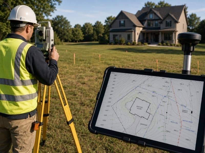
A mortgage survey shows where the home and other structures sit in relation to the property lines. A surveyor locates the boundaries, then maps the house, garage, fences and driveways against them. The lender uses that drawing to confirm nothing crosses a line or blocks an easement.
This type of survey answers the questions a lender cares about most. It confirms the house sits fully inside the lot, shows whether any structure encroaches on a neighbor and reveals easements that could affect the property. Clear answers keep the loan file clean.
A mortgage survey usually costs less than a full boundary or commercial survey, since it focuses on location rather than deep legal detail. That makes it a practical fit for a home loan. Still, it gives the lender the assurance it needs to move ahead.
Property Changes That Can Trigger a Survey Request
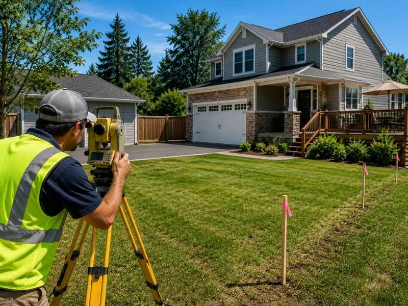
Changes to a home often prompt a lender to ask for a new survey. If someone added a room, built a deck or put up a fence since the last survey, those updates may not appear on the old drawing. The lender wants to see the property as it stands now, not as it looked years ago.
Some changes carry more weight than others. A new addition near a property line, a pool close to an easement or a driveway that shares space with a neighbor can all raise real questions. Each one gives the lender a reason to confirm the current layout.
Even work you didn’t do can matter. A past owner may have built something that never made it onto the records, and a fresh survey brings it to light. Clearing that up early keeps a small surprise from stalling your loan.
Why an Old Survey May Fall Short
An old survey can be a useful starting point, but it may not reflect the property today. Boundaries don’t change, yet the things on the land do. Structures go up, fences move and driveways expand, and an outdated drawing misses all of it.
Lenders and title companies notice these gaps quickly. If the current property doesn’t match a decades-old survey, they may ask for an update before they’ll proceed. An old document can’t confirm anything that appeared after the surveyor finished it.
Age alone can be a problem too. Some lenders set limits on how old a survey can be for a loan, regardless of whether anything changed. When your survey falls outside that window, a fresh one clears the requirement fast.
How an Updated Survey Keeps Closing on Track
An updated survey can keep your closing from slipping. When the lender has current, accurate details up front, it can finish its review without pausing for more information. That steady flow matters when a closing date is already set.
Missing or outdated survey information does the reverse. A lender may hold funding, or a title company may raise an issue it can’t clear, and your closing slips. Those delays can cost you a rate lock or even the whole deal.
Getting the survey handled early takes that risk off the table. Ask your lender what they require as soon as you can, so a surveyor has time to do the work. A little planning here saves a lot of stress at the finish line.
Frequently Asked Questions
Why would a lender ask for a mortgage survey?
A lender wants to be sure the property is worth the loan and free of boundary problems. A mortgage survey confirms the home sits within its lines and that no structure encroaches or blocks an easement. That assurance protects the money the lender puts into your home.
Is a mortgage survey required for every loan?
Not always. Some lenders and loan types skip it, while others treat it as a standard step before closing. Requirements also vary by state and by the property itself, so the best move is to ask your lender what they need early on.
Can an old survey be used for a mortgage?
Sometimes, if the property hasn’t changed and the lender accepts its age. Many lenders, though, set a limit on how old a survey can be, or they require an update when someone has altered the home. When the old one doesn’t qualify, a new survey settles the matter quickly.
What property changes may require an updated survey?
New additions, decks, fences, pools and driveways are common triggers. Any change that sits near a boundary or an easement can raise a question a lender needs answered. Even work done by a previous owner may call for a fresh survey if it never reached the records.
Can a new survey help prevent closing delays?
Yes. When the lender and title company get current details early, they can finish their review without stopping to ask for more. That keeps your closing date on track and protects a rate lock you don’t want to lose.


 Land Surveyors are professionals who make precise measurements to determine the size and boundaries of a piece of real estate. While this is a simplistic definition, boundary surveying is one of the most common types of surveying related to home and land owners. If you fall into the following categories, please click on the appropriate link for more information on that subject: