
When Do You Need an Elevation Certificate and How Much Does It Cost?
Your mortgage lender sends a letter. It says you need flood insurance. You call your insurance agent and the first thing they ask for is an elevation certificate. If you’ve never heard of one before, you’re not alone. Most property owners only find out about elevation certificates when someone else requires them. This article explains exactly when you need one, what the process looks like, and what you should expect to pay.
What an Elevation Certificate Is
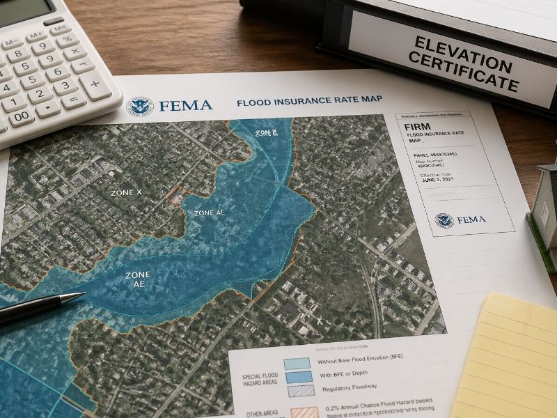
An elevation certificate is an official document completed by a licensed land surveyor. It records the elevation of a structure relative to the Base Flood Elevation (BFE) set by FEMA for that area.
The BFE is the height floodwater is expected to reach during a 1% annual chance flood event. If your structure sits below that line, your flood insurance premium goes up. If it sits above it, your premium may drop significantly.
The certificate captures several specific measurements:
- The lowest floor elevation of the building
- The lowest adjacent grade (the ground right next to the structure)
- The elevation of any attached garage or crawl space
- The elevation of mechanical equipment serving the building
- The flood zone designation from FEMA’s current maps
That data goes directly to your insurance company. They use it to calculate your premium.
When Do You Need an Elevation Certificate
Your Lender Requires It
Federal law requires flood insurance on structures with federally backed mortgages located in Special Flood Hazard Areas (SFHAs). Lenders routinely request an elevation certificate as part of that process.
If you’re buying a property in a mapped flood zone and financing it through a bank or mortgage company, expect this requirement to come up before closing.
Your Flood Insurance Premium Seems Too High
FEMA uses flood zone designations to assign base insurance rates. Those designations are based on maps, and maps aren’t always accurate at the property level.
An elevation certificate gives the insurance company actual measurements instead of map assumptions. If your structure sits higher than the BFE suggests, a certificate can bring your annual premium down by hundreds or even thousands of dollars.
Ordering one makes sense any time your flood insurance cost feels out of proportion to your actual site conditions.
You’re Building in or Near a Flood Zone
Developers and builders working in areas with SFHA designations often need an elevation certificate at two points: once during design to confirm proposed finished floor elevations meet local ordinance requirements, and again after construction to document the as-built elevations for the certificate of occupancy.
Many jurisdictions require this as part of the building permit process. Check with your local floodplain administrator before design begins.
You Want to Apply for a LOMA
A Letter of Map Amendment (LOMA) removes a specific property or structure from a FEMA flood zone designation. To apply for one, you need an elevation certificate showing the lowest ground elevation adjacent to the structure is at or above the BFE.
If approved, a LOMA can eliminate the mandatory flood insurance requirement entirely. That’s a significant financial outcome for property owners who are mapped into a flood zone but sit physically above the flood risk.
How Much Does an Elevation Certificate Cost
Prices vary. There’s no fixed national rate because the cost depends on the complexity of the survey, the size of the structure, the accessibility of the site, and the local market.
Most residential elevation certificates fall in a range of $150 to $800. Simple structures on accessible lots in straightforward flood zones sit toward the lower end. Properties with multiple buildings, difficult access, or complex flood zone situations cost more.
Commercial properties and larger development sites can run higher, sometimes well above $1,000, depending on scope.
A few things that push the cost up:
- The property hasn’t been surveyed recently and the surveyor needs to establish control
- The site has multiple structures that all need to be documented
- The flood zone is a V Zone (coastal high hazard area), which requires additional measurements
- The site is in a remote or difficult-to-access location
Some surveyors offer the elevation certificate as an add-on to a boundary or topographic survey already in progress. If you’re already paying for survey work on a property, ask whether the certificate can be included at a reduced additional cost.
How Long It Takes
Most residential elevation certificates are completed within one to two weeks from the date the surveyor visits the site. The field work itself takes a few hours. Processing and drafting the finished certificate takes a few days.
If you’re working against a permit deadline or a closing date, tell the surveyor upfront. Some firms offer faster turnaround for an additional fee.
Who Can Complete an Elevation Certificate
Only a licensed professional can sign and certify an elevation certificate. That means a licensed land surveyor, a licensed professional engineer, or in some cases a licensed architect who is authorized to certify elevation information under state law.
In practice, most elevation certificates are completed by licensed surveyors. If someone without those credentials offers to prepare one for you, the document won’t be accepted by FEMA, your lender, or your insurance company.
Frequently Asked Questions
When do you need an elevation certificate?
You need one when a lender requires flood insurance on a federally backed mortgage, when you’re building in a flood zone, when you want to lower your flood insurance premium, or when applying for a LOMA to remove a property from a flood zone designation.
How much does an elevation certificate cost?
Most residential certificates cost between $150 and $800. The price depends on site complexity, flood zone type, structure size, and whether recent survey control already exists on the property. Commercial sites and V Zone properties typically cost more.
Can an elevation certificate lower my flood insurance?
Yes. If your structure sits above the Base Flood Elevation, the certificate gives your insurer actual elevation data instead of map-based assumptions. That can reduce your annual premium by a meaningful amount, sometimes by several hundred dollars per year.
How long does an elevation certificate take?
Field work takes a few hours. The finished certificate is usually delivered within one to two weeks. Faster turnaround is available from some firms for an additional fee.
Does an elevation certificate expire?
FEMA doesn’t set a fixed expiration date, but certificates become outdated when flood maps in the area are revised. If the flood zone designation for your property changes, you’ll likely need a new certificate to reflect the updated maps.