
What Documents Does a Licensed Surveyor Use Before Starting a Survey?
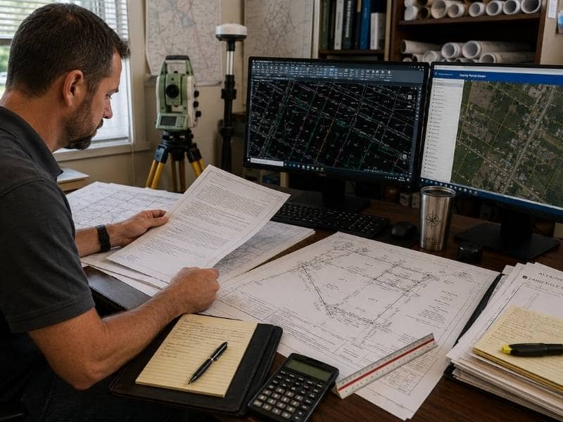
A licensed surveyor does a lot of quiet work before ever stepping onto a property. Good field measurements start with good paperwork, so the desk research comes first. A licensed surveyor gathers records that explain who owns the land, where the lines fall and what has been recorded over the years. This early research gives the crew a clear plan before any stakes go into the ground.
Reviewing these papers first saves time and cuts down on mistakes. The right documents show past boundary decisions, old markers and rights that other people may hold on the land. When a licensed surveyor knows this ahead of time, the finished survey can match both the legal record and what sits on the ground today.
Why a Licensed Surveyor Reviews Property Records Before Visiting the Site
A survey is really two jobs joined together. One part happens at a desk, and the other happens outside with measuring tools. The desk work comes first because it shapes almost everything the crew does later.
When a licensed surveyor studies records early, patterns start to show. An old description might point to a fence, a creek or a road that once marked a corner. If two records disagree, the licensed surveyor spots that conflict before the visit instead of standing puzzled in a field. That early preparation makes the outdoor work faster and far more accurate.
How Deeds Help a Licensed Surveyor Define Property Boundaries
The deed is one of the first papers a licensed surveyor opens. It holds the legal description of the land, which spells out the shape and size of the parcel in words and measurements. This description often lists directions, distances and points that trace the outline of the property.
A deed also names the current owner and points back to earlier deeds in the chain of ownership. By following that chain, a licensed surveyor can see how the land was split or joined over time. These clues help the crew understand where each property boundary should sit today, even when the wording is old or hard to read.
How Previous Surveys Give a Licensed Surveyor Valuable Reference Points
Land rarely gets surveyed only once. When an older survey exists, it becomes a helpful guide for the new one, and a licensed surveyor compares that past drawing with how the property looks now. Small differences between the two can tell a useful story.
Older surveys often list the markers that were set in the ground, such as iron rods or concrete corners. They also record the exact measurements taken between those points. If the crew can find the same markers again, the new survey lines up neatly with the older record and confirms the boundaries.
Why Plats and Recorded Maps Matter to a Licensed Surveyor
Plats and recorded maps show the bigger picture around a single lot. A plat is an official map that lays out how a larger piece of land was divided into smaller parcels. It gives lot numbers, dimensions and the shape of each piece in a neighborhood.
These maps also mark easements and rights-of-way, which are strips of land set aside for things like utilities or roads. A licensed surveyor reads them to see how one lot connects to the ones beside it. Without this wider view, it would be hard to place a single parcel correctly inside the whole area.
Additional Documents a Licensed Surveyor May Review Depending on the Project
The purpose of a survey changes which papers matter most. A simple boundary check needs fewer records than a project tied to new construction or a property sale. Depending on the job, a licensed surveyor may pull extra documents to fill in the missing details.
Some of the additional records a licensed surveyor might review include:
- Easement papers that explain who can use part of the land and why
- Title commitments that list recorded rights, liens or restrictions
- Construction plans that show planned buildings, grading or utilities
- Government or county records tied to zoning, permits or past filings
Each of these adds another layer of understanding to the file. The licensed surveyor selects only the records that fit the project, so the research stays focused and never wanders into documents that do not support the work.
Frequently Asked Questions
What documents should I provide to a licensed surveyor before a survey begins?
Share any deed, past survey or title paperwork you already have. Old plats, permits and property tax records can help too. Even partial paperwork gives the licensed surveyor a stronger starting point and can reduce research time.
Can a licensed surveyor complete a survey without an existing deed?
Yes. Although a deed makes the work easier, a licensed surveyor can still complete the survey by using county records, recorded maps and older filings to rebuild the legal description. The process may take more research, but the boundaries can still be established.
Does a licensed surveyor use county property records during the survey process?
Yes. County records are a common source of information because they contain recorded deeds, maps and filings that document ownership and changes to a parcel. A licensed surveyor reviews these records to confirm details and identify information the property owner may not have.
Why does a licensed surveyor compare old surveys with current property conditions?
Property conditions change over time. Fences move, survey markers become buried and new structures are built. By comparing an older survey with current site conditions, a licensed surveyor can identify these changes and determine which evidence best represents the property’s legal boundary.