
How Survey Mapping Helps Plan Drainage and Utility Improvements
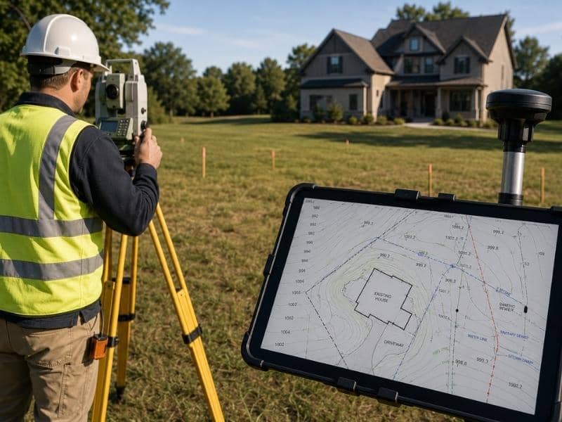
Drainage and utility projects begin with accurate information about the land. Survey mapping provides precise measurements of elevations, slopes and existing features, giving engineers, contractors and property owners the data they need to plan improvements with confidence. Starting with a reliable map helps reduce costly mistakes and keeps projects running smoothly.
Survey Mapping Puts the Ground on Paper
Survey mapping gives you a measured, accurate view of a property before any improvement work starts. Instead of eyeballing where the ground rises or dips, you get real numbers for the slopes, high points and low spots across the whole site. Good drainage and utility plans rest on that measured base.
The map matters because ground that looks flat rarely is. A yard can fall a foot or two from one side to the other, and that gentle tilt decides where water goes and where a line can run. Survey mapping catches those small differences that the eye misses.
With that picture in hand, you plan improvements around how the land actually behaves. You place a drain where water already collects, or route a utility line along ground that supports it. The property guides the plan instead of the plan fighting the property.
Drainage Plans Depend on Accurate Ground Data
Water follows the ground, so a drainage plan is only as strong as the ground data behind it. Survey mapping shows which way the land slopes and where rain tends to pool after a storm. Without that, a new drain or swale can land in the wrong place and make flooding worse.
Say a property gathers water near a back corner every time it rains. The map pinpoints that low area and the route the water takes to reach it. A designer can then set the grade, place drains and steer flow so the system pulls water away from the house.
Accurate ground data also prevents costly mistakes. Put a driveway or pad in the wrong spot and you can trap water against the house instead of leading it away. Planning from a solid map keeps new improvements from creating fresh problems while they fix old ones.
Utility Work Needs the Right Space to Fit
Utility improvements need room, and survey mapping shows exactly where that room is. Water lines, sewer or septic, power and access paths all have to fit on the property without clashing with each other or with what’s already there. A clear map lays out that space so nothing ends up crowded.
Good survey mapping helps a utility plan account for:
- Existing lines and connections already on the site
- Easements and setback limits that restrict where work can go
- Firm ground for service areas and maintenance access
- Soft or low spots that new lines should route around
With all of that on one map, a crew can place the new system correctly the first time. That saves the property owner from tearing up finished work to fix a layout mistake. The map turns a guessing game into a clear plan.
Clear Maps Help Crews Work Safely
A good map does more than guide design. It keeps the crew safe once digging begins. When workers can see marked utilities, slopes and boundaries, they avoid the surprises that cause accidents and damage.
Hitting an unmarked line is one of the biggest dangers on any dig. Survey mapping records where known lines run, which helps a crew plan careful digging and call for locates where needed. That lowers the risk of striking power, gas or water during the job.
Clear maps cut down on confusion too. Everyone on site works from the same reference, so there’s less guessing about where to dig or set equipment. A crew that knows the ground moves faster and makes fewer mistakes.
Saved Maps Pay Off During Future Repairs
A survey map stays valuable long after the improvements are finished. Save it, and you have a record of exactly where every drain, line and grade change sits. That record turns future repairs from a dig-and-hope job into a targeted fix.
Picture a clogged drain or a leaking line a few years down the road. With the old map, a crew finds the trouble spot fast and repairs it without tearing up half the yard. You save time, money and a lot of mess.
The same records help with bigger changes too. If you sell the property, add a structure or extend a system, the map shows what’s already underground. Keeping it on file means the next project starts with answers instead of questions.
Frequently Asked Questions
How does survey mapping help with drainage planning?
It shows the exact slope of the land and where water naturally collects. With that data, a designer can place drains and set grades so the system moves water away from buildings. Planning from a real map prevents a new drainage setup from backfiring.
Can survey mapping show low areas on a property?
Yes. Measuring elevation across the whole site reveals every dip and low spot, even the ones you can’t see by walking around. Those low areas often decide where water pools, which makes them key to any drainage or grading plan.
Why do utility projects need survey mapping?
Utility lines and access paths have to fit around existing systems, easements and setbacks. Survey mapping lays all of that out on one drawing, so crews route new work without clashing with what’s already there. That accuracy prevents expensive rework.
Can better maps help work crews avoid mistakes?
They can. A clear map shows marked utilities, slopes and boundaries, which helps crews dig carefully and steer clear of hidden lines. Everyone works from the same reference, so there’s less confusion and a lower chance of a costly slip.
Should survey records be kept after improvements are done?
Definitely. A saved map records where every line, drain and grade change sits, which makes future repairs faster and cheaper. It also helps whenever you sell, expand or add to the property later.