
Topo Survey for Solar Carport and Parking Canopy Design
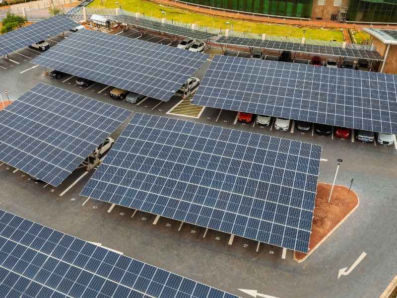
A topo survey gives commercial property owners, developers, and their solar design teams the measured site data they need before the first column location is drawn. A parking lot can look flat from the driver’s seat and still drop two feet from one end to the other. That slope matters once you start setting steel columns and long canopy beams over it. Solar carports also need clear height for vehicles, safe drainage, and foundations that miss buried pipes and conduit.
Evaluating Parking Lot Elevations Before Solar Carport Design
Every carport design starts with ground heights. Survey crews collect spot elevations across the parking area, along curbs, and at high and low points. Those points are tied to a benchmark, which is a fixed reference with a known elevation. That gives every measurement on the project the same starting point.
Elevations drive clearance. Canopy height has to work for cars, delivery trucks, and sometimes emergency vehicles. Van-accessible parking spaces have a minimum vertical clearance under federal accessibility standards, and local rules may add more. A lot that slopes under a uniform canopy can leave some spaces with less headroom than others.
Elevation data also helps the design team set column heights so the solar panels sit at a consistent tilt. Without it, installers may end up adjusting parts in the field. That costs time and can affect panel alignment.
Mapping Pavement Slopes and Drainage Around Proposed Canopy Locations
Parking lots are built to shed water, so slopes are rarely random. The survey maps those slopes, along with inlets, swales, curb openings, and low spots where water collects. Contours, which are lines connecting points of equal height, make the drainage pattern easy to read on the drawing. That shows designers where water already flows.
Canopies change how rain reaches the pavement. Water that once fell across the whole lot now runs off the panel edges in concentrated lines. If those lines land over a low spot or a walking path, ponding and slip hazards can follow. Designers can use the survey to direct runoff toward existing inlets or plan new drainage where needed.
Adding a canopy over existing pavement may or may not trigger stormwater review. That depends on the municipality, the county, the water management district, and the project scope. Ask your civil engineer to check early. Good drainage data makes that conversation much faster.
Documenting Existing Utilities, Curbs, and Parking Lot Features
Carport columns need deep foundations, and those foundations have to miss what’s underground. The survey locates visible utility features such as manholes, valve boxes, inlets, pull boxes, and light poles. Crews can also tie in utility marks painted by a locating service. Deeper or unmarked lines may need a separate utility locating effort, which is worth discussing before field work.
Surface features matter just as much. The survey records curbs, islands, striping, wheel stops, sidewalks, trees, and signs. Column placement often depends on the space between parking stalls and islands. Accurate locations keep columns out of drive aisles and door swing zones.
Boundary and easement information should be part of the package too. Utility easements, access easements, and setbacks can limit where a canopy goes. If you have an ALTA or boundary survey, share it with the team so the topographic data can be tied to it.
Using Topographic Survey Data for Canopy Foundations and Site Layout
Engineers turn the field data into a base map that guides both structural and site design. Column grids are set to fit parking stalls, clear underground lines, and match the slope. Foundation designers use the elevations to set pier heights and plan for grade changes across the canopy footprint. A topo survey also helps estimate how much pavement will need to be cut and patched.
Electrical routing depends on this map. The conduit path from the canopy to the inverters, electrical room, or utility transformer often crosses pavement and landscaped areas. Knowing the location of existing lines and structures helps designers pick a trench route with fewer conflicts. That can save money during construction.
Soils and foundations are a separate study. A geotechnical engineer evaluates the ground for pier design, while the survey shows where and at what elevation those piers will sit. Both are needed before structural plans are final.
Coordinating Survey Measurements With Solar Carport Design Requirements
Survey data works best when the whole team uses the same reference. Agree on the vertical datum and coordinate system before design begins. Share files in CAD or 3D formats that the solar designer, structural engineer, and civil engineer can all open. Small mismatches between consultants can shift a column several inches.
Permit reviewers may ask for signed and sealed survey documents with the application. Some jurisdictions want existing grades, utilities, and clearances shown on the plans. Requirements vary by city, county, and project type. Confirm the list early so the survey deliverables match what reviewers expect.
Plan for survey support during construction as well. Construction staking marks the exact column locations so crews can drill in the right spot. An as-built survey may be required at the end to confirm finished locations and heights.
Frequently Asked Questions
What does a topo survey include for a solar carport project?
It typically includes spot elevations, contours, and pavement slopes across the parking area. Crews also locate curbs, islands, drainage structures, light poles, and visible utility features. The data is tied to a fixed elevation reference. Ask the survey firm to confirm the exact scope in writing.
Why can’t the design team use an aerial image instead?
Aerial images show layout but don’t give reliable ground elevations or utility details. Column heights and clearances depend on accurate grades. Drainage structures and underground features also need field measurement. Some projects combine drone mapping with ground survey to cover large lots efficiently.
How long does a parking lot survey take?
Timing depends on lot size, the number of features, and access during business hours. A small lot may take a day or two of field work. Large lots with many inlets and utilities can take longer. Order early if a permit or construction schedule depends on the data.