
Establishing Wetland Buffer Limits With a Boundary Line Survey
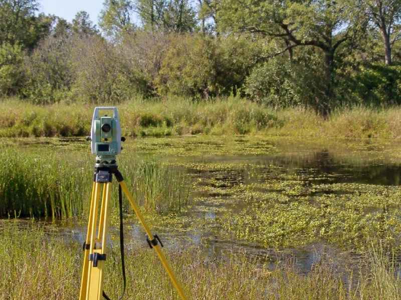
A wetland can shrink where you build. Near one, a buffer strip is often off limits. That buffer eats into your usable land. If you don’t know where it falls, you can plan in the wrong spot. A boundary line survey gives you a firm base to measure from.
A boundary line survey finds and marks the legal edges of your property. A licensed surveyor locates each corner and measures each line. The work rests on your deed, past records, and field checks. The result is a map of your true property limits.
Start with that map before you deal with a wetland buffer. A buffer is measured from a known line, so the line has to be right. Get the boundary set first. Then the buffer, the setbacks, and your plans all sit on solid ground.
Wetland Buffers and Their Relationship to Property Limits
A wetland buffer is a strip of land next to a wetland. It acts as a guard between your project and the protected area. Rules often limit or block buildings inside it. That makes the buffer a key factor in your plans.
The buffer connects straight to your property limits. Your usable land is what’s left after the buffer is removed. If the buffer is large, it can take a big bite. Knowing your true lines shows how much land you really have.
A boundary line survey defines those true lines. It shows where your parcel starts and stops. From there, you can see how the buffer overlaps your land. This helps you plan around it instead of guessing.
Buffer rules are not the same everywhere. They vary by state, county, and the type of wetland. Some are wide, and some are narrow. Confirm the rules for your site early, since they shape what you can build.
A Boundary Line Survey as the Base for Buffer Delineation
Buffer delineation means marking where the buffer starts and ends. It sets the edge of the protected strip on your land. This work needs a solid base to measure from. A boundary line survey is that base.
The buffer edge is often set a fixed distance from the wetland. That distance is measured with care in the field. A crew needs known points to measure from and to. Your surveyed boundary gives them those points.
Here’s how the survey supports buffer work:
- It fixes your property corners and lines
- It gives a base to measure the buffer distance
- It ties the buffer to real points on the ground
- It shows the buffer against your usable land
The wetland edge itself is usually set by an environmental specialist. They flag where the wetland begins. The surveyor then locates those flags and maps them. The two roles work together to draw a clear buffer line.
Good measurements protect you here. A buffer placed by guess can be wrong. That can lead to fines or a forced redesign. A survey-based buffer stands on firm, provable data.
Parcel Corners, Setbacks, and Environmental Constraint Areas
Your parcel corners are the base for everything else. A corner is a point where two property lines meet. The surveyor finds or sets a marker at each one. These marks anchor the whole map.
Setbacks build on those corners. A setback is a required gap between a structure and a line. You may have setbacks from the road, the sides, and the rear. A wetland buffer acts like another kind of setback.
Together, these limits shape your buildable area. That’s the space left where you can actually build. Stack up the setbacks and the buffer, and the usable space can shrink fast. A clear survey shows what remains.
Environmental constraint areas add more limits. These are zones with rules that restrict use. A wetland and its buffer are common examples. Floodplains and drainage areas can be too.
On low, flat sites, water features are common. Ponds, ditches, and wet soils can all create constraints. A boundary line survey helps map these against your lines. This gives you a real picture of where you can and cannot build.
Survey Coordination With Wetland and Site Planning Information
A survey does not work alone on these projects. It joins with wetland data and site plans. Each source adds a piece of the puzzle. Together they guide a safe, legal design.
The surveyor ties the wetland flags to your boundary. They map the flag points with the same control used for your lines. This puts the wetland, the buffer, and your parcel on one map. Everyone then works from the same base.
Engineers and planners use that map to design the site. They place buildings, roads, and drainage around the limits. Good survey data keeps their plans out of the buffer. It also helps them plan drainage that protects the wetland.
This teamwork matters for permitting. Reviewers check that your plan respects the buffer. A clear, survey-based map answers many of their questions. Coordination needs can vary by agency and project, so confirm them early.
Clear Boundary Line Survey Data for Future Design and Permitting
Clean survey data pays off down the road. It gives your team a base for design and permits. It also creates a record you can return to later. That saves time and money on future work.
For design, the survey shows the buildable area clearly. It marks the lines, the setbacks, and the buffer. Your team can plan with real limits, not rough guesses. This lowers the risk of a costly redo.
For permitting, clear data builds trust with reviewers. It shows you know your limits and respect them. A strong map can move a review along. A weak one invites delays and more questions.
Keep these points in mind before you start:
- Order the boundary line survey early
- Gather your deed and any past surveys
- Ask how the wetland data will be tied in
- Confirm buffer and permit rules for your site
Requirements can vary by property type, county, and project scope. Confirm your survey and permit needs early, since timing may depend on them. A licensed surveyor can help you line up the boundary work with your wetland and design plans.
Frequently Asked Questions
What is a wetland buffer and why does it matter?
A wetland buffer is a strip of land next to a wetland that helps protect it. Rules often limit or block building inside this strip. It matters because it can reduce how much of your land you can use. Knowing where it falls helps you plan and avoid fines or redesigns.
How does a boundary line survey help with wetland buffers?
A boundary line survey fixes your true property lines and corners. Those lines give a solid base to measure the buffer from. The surveyor can then tie the wetland flags and buffer edge to your parcel. This puts your land, the buffer, and the limits on one clear map.
Does the surveyor decide where the wetland begins?
Usually no, the wetland edge is set by an environmental specialist. They flag where the wetland starts in the field. The surveyor then locates those flags and maps them against your boundary. The two roles work together to draw an accurate buffer line.