
A Construction Surveyor for Roads Built in Several Project Phases
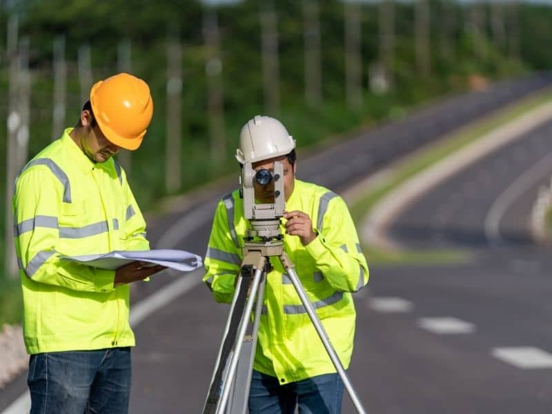
A road built in phases is really several projects that have to line up as one. The second phase has to meet the first at the right line and the right height. Before each phase begins, the team needs accurate information about the existing site features that affect the work, including drainage structures, utilities, and surrounding improvements. Miss by a little and the pavement does not match, the drainage fights itself, and the lanes drift. A construction surveyor keeps every phase tied to the same reference points so the finished road reads as one smooth stretch.
The risk on these jobs is drift. Small errors early can grow across phases and show up as expensive rework later. Keeping consistent survey control from start to finish is what prevents that. Get the control right, protect it, and each phase starts from solid ground.
Why Phased Road Projects Need Consistent Survey Control
Survey control is a network of fixed reference points that everything on the project is measured from. It has a horizontal part, which sets position, and a vertical part, which sets height. Every stake, grade, and structure ties back to this network. Through survey mapping, the construction team can visualize these control points and the existing site conditions while keeping each phase connected to the same reference system. On a phased road, that same control has to carry across every phase and every month of work.
The problem comes when phases drift apart. If a later phase is built from different or shifted control, it will not match what came before. The alignment can jog, the grades can step, and the two sections will not meet cleanly. One consistent control network keeps the whole road in agreement.
Protecting the control points is part of the job. Construction is hard on markers, and equipment can bury or destroy them between phases. A construction surveyor sets durable points clear of the work and checks them over time. That way the control is still good when the next phase begins.
How Construction Surveyors Support Road Layout and Expansion
The core work is turning the plans into marks on the ground. The construction surveyor stakes the centerline, which is the reference line running down the middle of the road. They mark stationing along it, which is the measured distance system used to locate every point on the project. This gives the crew a clear framework to build from and helps maintain the correct site grades throughout the roadway layout.
From there, the surveyor sets the stakes that control shape and height. They place grade stakes and offset stakes for cutting and filling, for the subgrade, the base, and the final pavement. They also locate curbs, drainage structures, and the edges of the roadway. Each mark tells the crew exactly where and how high to build.
Expansion work leans on this even more. Adding lanes or extending a road means tying the new work precisely to the road already there. The surveyor measures the existing pavement and matches the new alignment and grade to it. Done right, the addition feels like it was always part of the road.
Managing Site Changes Between Road Construction Phases
A road site never stays still. Earth gets moved, traffic gets shifted, and stakes get knocked out as work goes on. Between phases, many of the day-to-day marks are gone. The construction surveyor re-establishes them from the protected control so the next phase starts accurately.
As-built checks are a big part of managing the change. An as-built survey records where things were actually built compared with the design. Running one at the end of a phase confirms the work matches the plans before the next phase begins. If something drifted, it is caught while it is still cheap to correct.
Temporary conditions need attention too. Phased roads often run live traffic through detours and shifted lanes while work continues. The surveyor helps lay out those temporary alignments so they are safe and correct. Then the permanent work picks up cleanly when the phase is ready.
Coordinating Survey Data With Engineering and Construction Plans
Good roadwork depends on everyone sharing the same reference. The surveyor, the design engineer, and the contractor all work from one coordinate system and one datum. When they do, the field, the plans, and the finished road agree. When they do not, small differences turn into real mismatches on the ground.
The construction surveyor sits between the plans and the dirt. They translate the engineer’s drawings into stakes the crew can build to. They also measure what gets built and report it back, so the design team knows the true field conditions. That two-way flow keeps everyone working from current information.
Requirements are not the same on every job. What a road project must document and how it gets accepted can vary by municipality, county, agency, and project scope. Public roadway work often carries its own survey and record standards. Confirm those requirements early, since timing and acceptance depend on meeting them.
Reducing Delays Through Accurate Roadway Survey Management
Most delays on phased roads trace back to an error found too late. A grade that does not match, an alignment that jogs, a structure set in the wrong spot. Fixing those after paving is slow and costly. Steady survey management catches them before they become rework.
Consistent control and regular as-builts are the tools that keep things on track. They confirm each phase is right before the next one starts, so problems do not carry forward. That keeps inspections and acceptance moving instead of stalling. A road that checks out phase by phase finishes with fewer surprises.
Planning makes the difference. Bring the construction surveyor in early, protect the control from the start, and keep clean records through every phase. Those steps cost little and save a lot. A licensed survey team can set the project up so the phases fit together as planned.